Members Platform
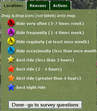
Example of a PPGIS tab with markers to be placed on map
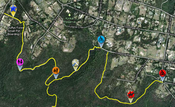
PPGIS markers placed on map
Participatory visitor activity monitoring in NSW national parks
Part of this research was presented in the following publications. Author copies are available from ecoresearcher@online.ms
Wolf, I.D., Wohlfart, T., Brown, G., & Bartolomé Lasa, A. (2015). The use of public participation GIS (PPGIS) for park visitor management: a case study of mountain biking. Tourism Management, 51, 112–130.
Wolf, I.D., Brown, G. & Wohlfart, T. (2017). Applying Public Participation GIS (PPGIS) to inform and manage visitor conflict along multi-use trails. Journal of Sustainable Tourism, (accepted). full pre-print text, abstract
Participatory planning of public lands
Participatory planning of public lands is a relatively new and innovative development in visitor experience management of parks and other protected areas. In this study we used public participation geographic information system (PPGIS) mapping and GPS tracking combined with questionnaire-based surveying to evaluate distributions and needs of mountain bikers and horse riders in selected national parks and surrounding land tenures in Northern Sydney. The PPGIS mapping was implemented using both an internet application and with hardcopy maps in the field.
Research aims
This research addressed three fundamental questions for park visitor planning: (1) What is the spatial distribution of visitor activities and (2) location-specific reasons for riding; and (3) What location-specific actions are needed to improve riding experiences?
Research sample
More than 650 mountain bikers and more than 100 horse riders who frequent the Northern Sydney area participated in this research. The research received highly positive feedback in mountain biker forums achieving a high amount of word-of-mouth recommendation.
Close to 14,000 locations were mapped by participants showing places where people ride, motivations to ride there and actions required to improve experiences.
In addition in-depth survey data were collected on rider demographics, skill levels and preferences. Extensive open-ended comments were collected including 443 comments from horse riders, yielding 1787 individually coded comments; along with 1882 comments received from mountain bikers, yielding 7793 individually coded comments.
Research findings
This research generated in-depth information about the place and frequency of mountain biking and horse riding in Northern Sydney, including the relative popularity of and motivations to ride in different areas and along specific tracks, effectively addressing the first and second question about the distribution and reasons for rides.
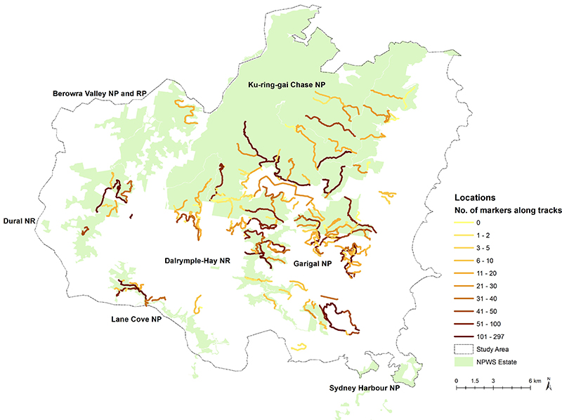
Fig.1 Distribution of mountain bikers along selected tracks in Northern Sydney. Dark tracks indicate popular rides.
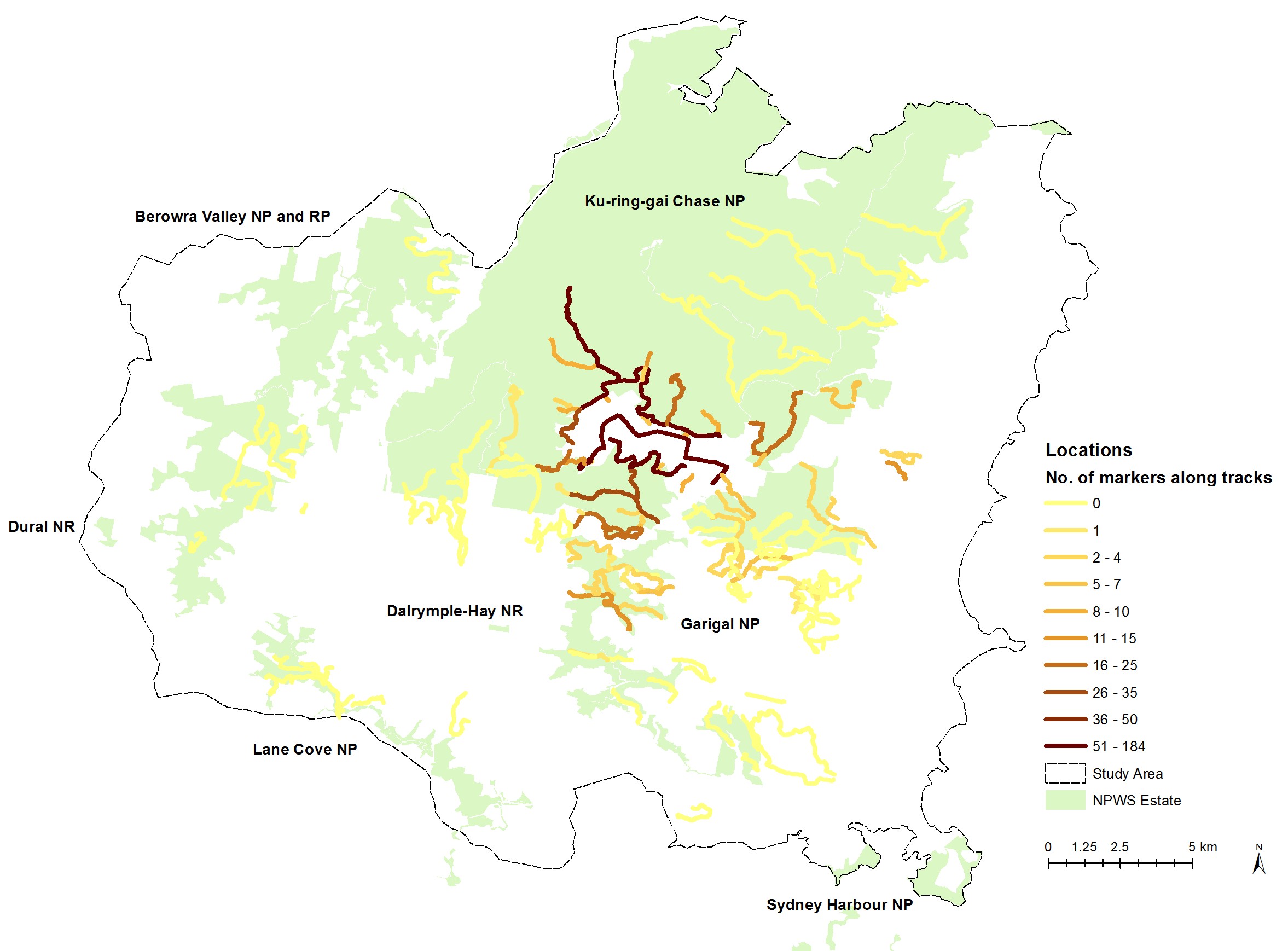
Fig.2 Distribution of horse riders along selected tracks in Northern Sydney. Dark tracks indicate popular rides.
Extensive information was generated on actions required to improve rider experiences including maintenance of tracks, track linkages, improve track design, closure of tracks and the occurrence of visitor conflicts.
Several hundred maps and tables were generated on the distributions, motivations and actions mapped by mountain bikers and horse riders. This information was provided at multiple scales such as inside vs. outside of parks and specific parks and tracks.
The methodology was critically evaluated and differences discussed between the PPGIS internet application and hardcopy data collection in the field, and the PPGIS mapping and GPS tracking.
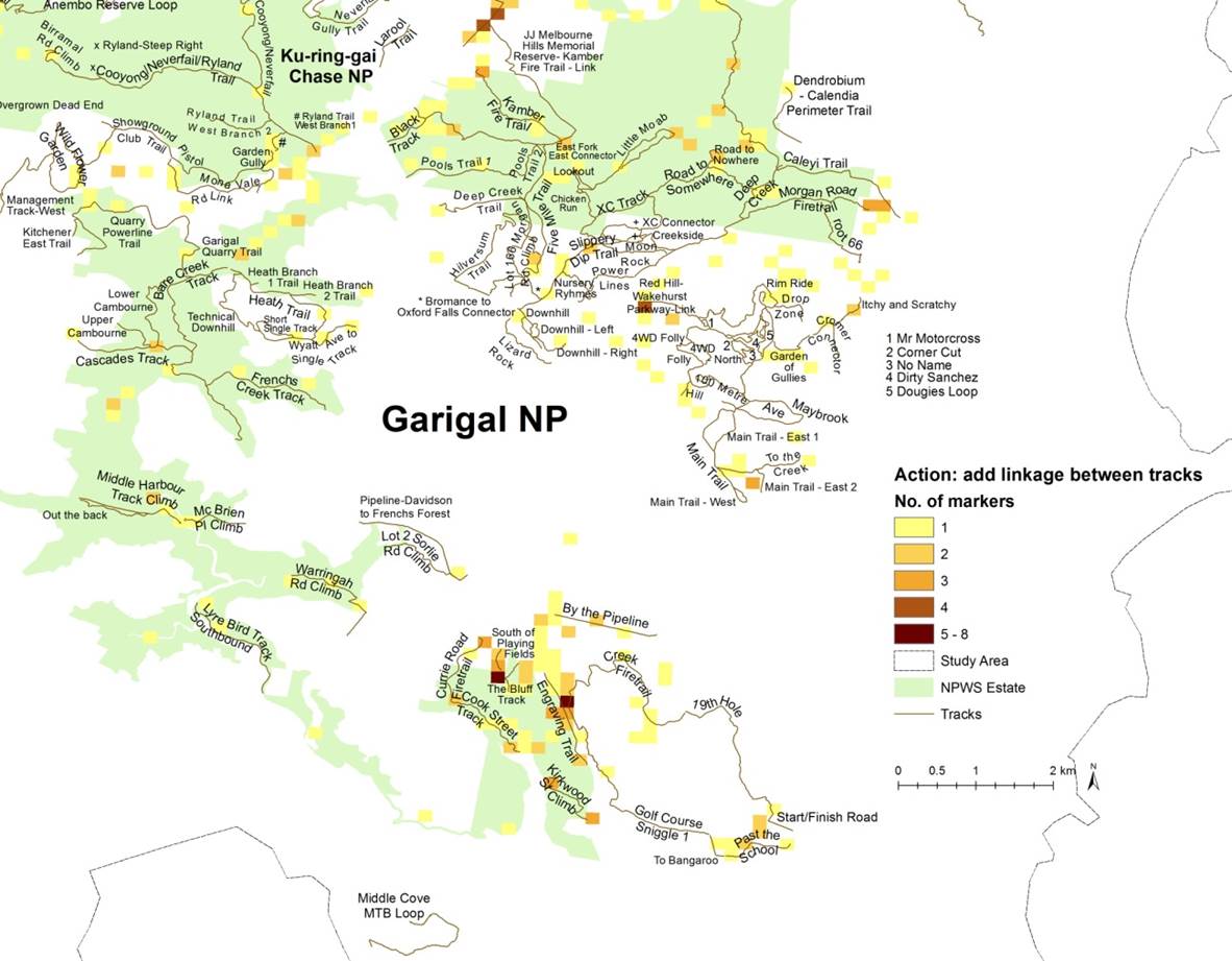
Fig.3 Mapping of linkages between tracks frequented by mountain bikers in the South East of Northern Sydney.
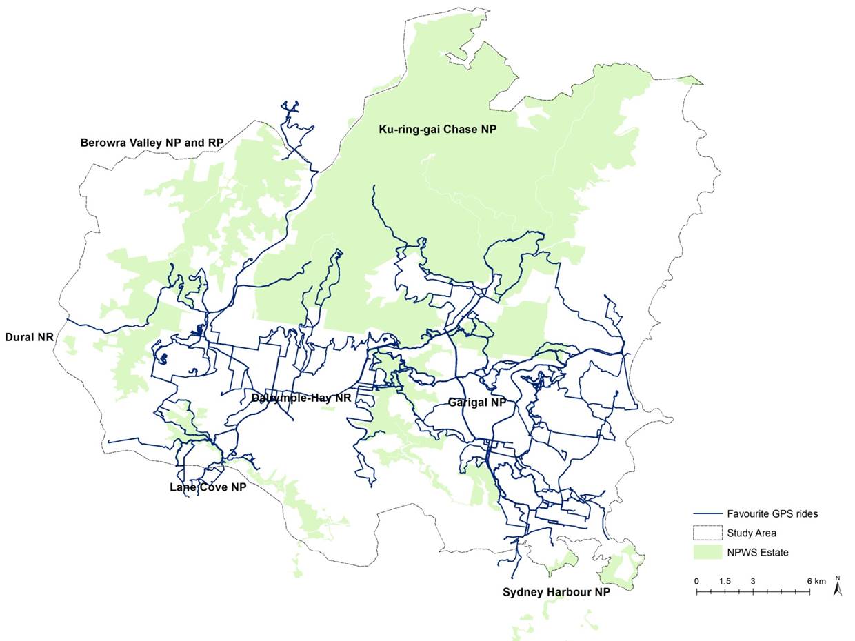
Fig.4 Favourite rides collected via GPS tracking by mountain bikers in Northern Sydney.
The survey data provided additional market insights on rider demographics, skill levels and preferences for experiences and facilities along with information on the occurrence and management of visitor conflicts.